
 Outdoor enthusiasts in the Anchorage area can learn how to use a GPS with map software to plan hikes, hunts and other activities in a free clinic at REI this Thursday at 7 p.m.
Our Jeff Caulfield will take you through a simple trip planning exercise, discuss "on the trail" applications of GPS and give you tips on how to use GPS in the navigation process.
Jeff will have some freebies for attendees -- disks with a guide to Map & GPS use, trails, and GMU boundaries to add to yout TOPO! maps.
Showing posts with label recreation maps. Show all posts
Showing posts with label recreation maps. Show all posts
October 26, 2008
NatGeoMaps Goes North to Alaska
Filed under:
GPS,
navigation,
public demos/clinics,
recreation maps,
TOPO

Sphere It!


September 5, 2008
Navigating with National Geographic: Seattle Region
Outdoor enthusiasts in the Seattle area can learn how to use a GPS with map software to plan hikes and other activities in a series of free evening clinics at REI next week.
Our Jeff Caulfield will take you through a simple trip planning exercise, discuss "on the trail" applications of GPS and give you tips on how to use GPS in the navigation process.
Clinics begin at 7 p.m. Click on links for maps and directions to each store:9.8.08 :: REI Tacoma, WA
9.9.08 :: REI Redmond, WA
9.10.08 :: REI Seattle, WA
9.11.08 :: REI Issaquah, WA
Filed under:
GPS,
navigation,
public demos/clinics,
recreation maps,
TOPO
Sphere It!
August 15, 2008
Navigating with National Geographic: DC Area
Outdoor enthusiasts in the DC area can learn how to use a GPS with map software to plan hikes and other activities in a series of free evening clinics at REI next week.
Our Jeff Caulfield will take you through a simple trip planning exercise, discuss "on the trail" applications of GPS and give you tips on how to use GPS in the navigation process.
Clinics begin at 7 p.m. Click on links for maps and directions to each store:8.18.08 :: REI Timonium, MD
8.19.08 :: REI Fairfax, VA
8.20.08 :: REI Bailey's Crossroads, VA
8.21.08 :: REI College Park, MD
Filed under:
GPS,
navigation,
public demos/clinics,
recreation maps,
TOPO
Sphere It!
July 14, 2008
Video: Nat Geo's Outdoor Recreation Mapping Program
Here's an overview of our outdoor rec. map program including interviews with VP/Products Dan Ortiz and Trails Illustrated Product Manager Shane Matthews:
Filed under:
National Geographic maps,
recreation maps
Sphere It!
March 18, 2008
Nav Clinics Continue in California
NatGeo's Jeff Caulfield will present free Map & GPS navigation clinics again this week. Details on store links below.
Tuesday, March 18, 7 p.m. at REI Roseville
Wednesday, March 19, 7 p.m. at REI Fresno
Thursday, March 20, 7 p.m. at REI Folsom
Filed under:
GPS,
navigation,
public demos/clinics,
recreation maps,
TOPO
Sphere It!
March 10, 2008
Navigation Clinics in Northern California this week
 Outdoor enthusiasts in northern California can learn how to use GPS with map software to plan hikes and other activities at free evening clinics this week in Concord and Mountain View.
Jeff Caulfield will take you through a simple trip planning exercise, discuss "on the trail" applications of GPS and give you tips on how to use GPS in the navigation process.
Everyone who attends will receive a free CD with Basic Map and GPS Skills, other helpful info, and trail overlays to use with TOPO! digital maps.
Clinics begin at 7 p.m. Click on links for maps and directions to each store:
Tuesday, March 11:
REI Concord
Wednesday, March 12:
REI Mountain View
Filed under:
GPS,
navigation,
public demos/clinics,
recreation maps,
TOPO
Sphere It!
March 3, 2008
Navigate with NatGeo @ REI
Outdoor enthusiasts in northern California can learn how to use GPS with map software to plan hikes and other activities in a series of free evening clinics at REI.
Our Jeff Caulfield will take you through a simple trip planning exercise, discuss "on the trail" applications of GPS and give you tips on how to use GPS in the navigation process.
Everyone who attends will receive a free CD with Basic Map and GPS Skills, other helpful info, and trail overlays to use with TOPO! digital maps.
Clinics begin at 7 p.m. Click on links for maps and directions to each store:Tuesday, March 4:
REI Fremont
Wednesday, March 5:
REI Berkeley
Thursday, March 6:
REI San Carlos
Tuesday, March 11:
REI Concord
Wednesday, March 12:
REI Mountain View
Filed under:
GPS,
navigation,
public demos/clinics,
recreation maps,
TOPO
Sphere It!
February 4, 2008
NEW Trails Illustrated Map for SW Colorado!

MAP FEATURES:
Scale
1:63,360
Size
Sheet = 25.5” X 37.75”
Folded = 4.25” X 9.25”
Waterproof – Tear Resistant
Map Highlights
• San Juan National Forest
• San Juan & Piedra Rivers
• Vallecito & Lemon Reservoir
• State Wildlife Areas
• Chimney Rock Archaeological Area
• Piedra Natural Area
• Navajo State Park
Towns
• Pagosa Springs
• Bayfield
• Ignacio
Scenic Byways
• San Juan Skyway
Product Numbers
ISBN 13: 978-1-56695-239-2
ISBN 10: 1-56695-239-5
UPC: 749717001459
EAN: 9781566952392
Price
SRP = $11.95
OTHER MAP FEATURES:
This title provides overlapping coverage of the newly published TI144 Durango-Cortez, TI142 South San Juan-Del Norte & TI140 Weminuche.
• Detailed road and trail network
• Classed Trails by Use
• Locations of popular recreation sites
• Detailed road and trail network
• Classed Trails by Use
• Locations of popular recreation sites
Filed under:
recreation maps,
Trails Illustrated
Sphere It!
January 3, 2008
Outdoor recreation maps - great things on tap
We're cooking up some great things for outdoor recreation map users this year. mapXchange, our site for downloading trail and other map overlays to use with TOPO! will enjoy a major upgrade this spring.
Look for an announcement about this and other TOPO! news January 22nd.
Trails Illustrated will continue its march across northern California this year with great new maps.
And based on the success of National Parks Explorer 3D, Southern Appalachian Mountains Explorer 3D and Adirondack Park Explorer 3D, we're also working to make more TI maps available digitally.
December 3, 2007
Maps Lead to Adventure
That headline is a motto we've used for some time. But right now it's literally true.
Now through December 31st, purchase one of our outdoor recreation map software products and qualify for a one-year subscription to Adventure Magazine.

Participating dealers will have tear-off coupons for submitting your claim. Online retailers will have a PDF redemption form. You can also find it here.
The offer applies to the TOPO! State Series, Weekend Explorer 3D, Back Roads Explorer 3D, National Parks Explorer 3D and our other outdoor map software products.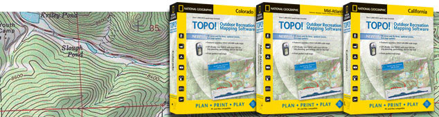
Where to buy:
Retail
Your local independent outdoor specialty shop.
Online
National Geographic Online Store
REI.com
GeoMart
Swiftmaps
Digital Map Store
Offroute.com
The GPS Store
GPS Now
Map Outfitter
Software-Maps.com
Amazon.com
Filed under:
gifts,
map software,
National Geographic maps,
recreation maps
Sphere It!
November 7, 2007
New Trails Illustrated Title: New River Blueway

National Geographic Maps is pleased to announce our newest Trails Illustrated title, but with a twist.
This title has a "Geotourism Feature" that not only highlights recreational amenities, but also the region's cultural and physical features of select areas of North Carolina, Virginia and West Virginia, with a focus on the New River, an EPA designated American Heritage River.
Whether you're planning a float trip or visiting the many protected parks and natural areas, this map can serve as an excellent trip-planning tool and cultural resource.
Subscribe to:
Posts (Atom)


