
New instructions for using TOPO! with Magellan Triton is now live at topo-triton.com along with details on how to contact us for support.
I hope you find a Triton + TOPO! under your tree!
December 21, 2007
New Triton Tech Info is Live
Filed under:
gifts,
GPS,
National Geographic maps,
TOPO,
topographic maps,
Triton
![]()
Sphere It!
![]()
![]()
![]()
![]()
![]()
December 20, 2007
Idiot Proof?
A member of our sales team called today and I mentioned I was in the midst of testing updated instructions on transferring TOPO! maps to Triton, having unboxed a 1500 unit.
He asked, "So you want to see if it's idiot proof?" I didn't take umbrage. He knows I'm not exactly a GPS power user.
The good news is the directions worked easily. We're just fine tuning them and some additional tips and will have them on the web in a day.
Since this was my first time handling a Triton I'll say I liked the feel of it, loved the screen, especially the touchscreen operation. And the TOPO! maps I transferred looked great.
Meanwhile, Magellan informs us that the flood gates have opened and many more Tritons will soon be washing into stores near you.
Filed under:
GPS,
Magellan,
National Geographic maps,
TOPO,
topographic maps,
Triton
![]()
Sphere It!
![]()
![]()
![]()
![]()
![]()
December 12, 2007
Question about Magellan Triton Delays
A Contours reader writes:
What is your view on the matter of the non-availability of a GPS-device (Magellan Triton) which is praised on your own web-page?
While we are not happy that the release has been delayed, more models are shipping to more stores each week. This is a new line that will be a standard for some years and so we view the delay as a short term disappointment.
While our relationship with Magellan is not exclusive, we are working closely with them and promoting the Triton line because they are the first company to do what thousands of our users and dealers have been asking GPS manufacturers to do for years: Allow them to transfer TOPO! maps to their handhelds.
Filed under:
GPS,
Magellan,
National Geographic maps,
TOPO,
topographic maps,
Triton
![]()
Sphere It!
![]()
![]()
![]()
![]()
![]()
December 3, 2007
Where to buy Triton GPS
Last month we let you know the exciting news about a new line of GPS handhelds that will be the first to support tranfer of TOPO! maps to view and track on-screen.
Magellan's Triton units have begun shipping. A report on where to find them appears here today.
Filed under:
GPS,
Magellan,
map software,
topographic maps,
Triton
![]()
Sphere It!
![]()
![]()
![]()
![]()
![]()
Maps Lead to Adventure
That headline is a motto we've used for some time. But right now it's literally true.
Now through December 31st, purchase one of our outdoor recreation map software products and qualify for a one-year subscription to Adventure Magazine.

Participating dealers will have tear-off coupons for submitting your claim. Online retailers will have a PDF redemption form. You can also find it here.
The offer applies to the TOPO! State Series, Weekend Explorer 3D, Back Roads Explorer 3D, National Parks Explorer 3D and our other outdoor map software products.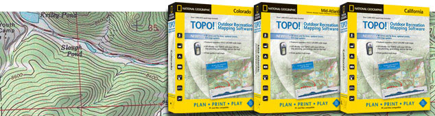
Where to buy:
Retail
Your local independent outdoor specialty shop.
Online
National Geographic Online Store
REI.com
GeoMart
Swiftmaps
Digital Map Store
Offroute.com
The GPS Store
GPS Now
Map Outfitter
Software-Maps.com
Amazon.com
Filed under:
gifts,
map software,
National Geographic maps,
recreation maps
![]()
Sphere It!
![]()
![]()
![]()
![]()
![]()
December 1, 2007
Concise Atlas of the World, Second Edition
National Geographic Books has just released the National Geographic Concise Atlas of the World, Second Edition, a condensed yet complete world portrait.
This edition includes more than 3,000 updates, 32 new pages of expanded content, and 500 maps, charts, graphs, flags and illustrations. All the maps are fresh, newly researched and state-of-the-art, reflecting the latest changes in the world. Topics covered are informative, relevant and interesting, providing readers with the most current geographic knowledge and global trends. 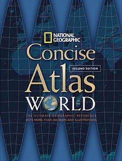

Smart navigational features and intuitive design elements make reference searches easy and quick.The atlas opens with beautifully rendered, up-to-date, thoroughly indexed, political and physical maps of the world. World thematic maps follow, presenting plate tectonics, climate and weather, oceans, population, religion, energy and the economy. Health and education, environmental stress, and conflict and terror are also covered, providing a review of the increasingly complex issues we face today.
A newly compiled time zone map is added, as well as a special section on the United States, providing more in-depth coverage, including population changes, most prevalent religious groups, risk to property from natural disasters, and national parks and reserves. The full-color physical and land cover maps enhance and enrich readers' understanding of Earth's natural features.
New continental maps cover water availability, dominant economies, energy consumption, population density, climate and natural events such as earthquakes, volcanoes and tsunamis. Country profiles provide valuable and useful facts for all 193 independent nations of the world. Never-before-published satellite mosaics depict the Earth in high resolution from hundreds of miles above.
It's a fantastic value at $24.95.
160 pages
350 color maps, graphics, satellite images, and photos
10 1/4 x 13 1/2
Softcover
10 1/4 x 13 1/2
Softcover
ISBN: 978-1-4262-0196-7
Filed under:
National Geographic maps,
world atlases
![]()
Sphere It!
![]()
![]()
![]()
![]()
![]()
Subscribe to:
Posts (Atom)


